Santa Barbara Foothill Communities CWPP and Transportation Study
With the increased severity and frequency of wildfires in California, community wildfire planning is increasingly important to help prepare for and adapt to wildfire. The Santa Barbara County Fire Department is preparing a Community Wildfire Protection Plan (CWPP) and Transportation Study for the Santa Barbara Foothill Communities (Plan Area). CWPPs are a tool to help guide wildfire planning projects that will reduce the severity and impact of wildfires and increase community resilience. Transportation Studies evaluate the availability and demand on access and egress routes in an area to identify where there are limited or sufficient access/egress routes that could be used during an evacuation or emergency. The CWPP and Transportation Study are being developed by the Santa Barbara County Fire Department with input and direction from interested parties, agency representatives, and community members.
Project Funding
The project is being funded by a Community Development Block Grant for Mitigation-Planning and Public Service from the U.S. Department of Housing and Community Development.
Plan Area
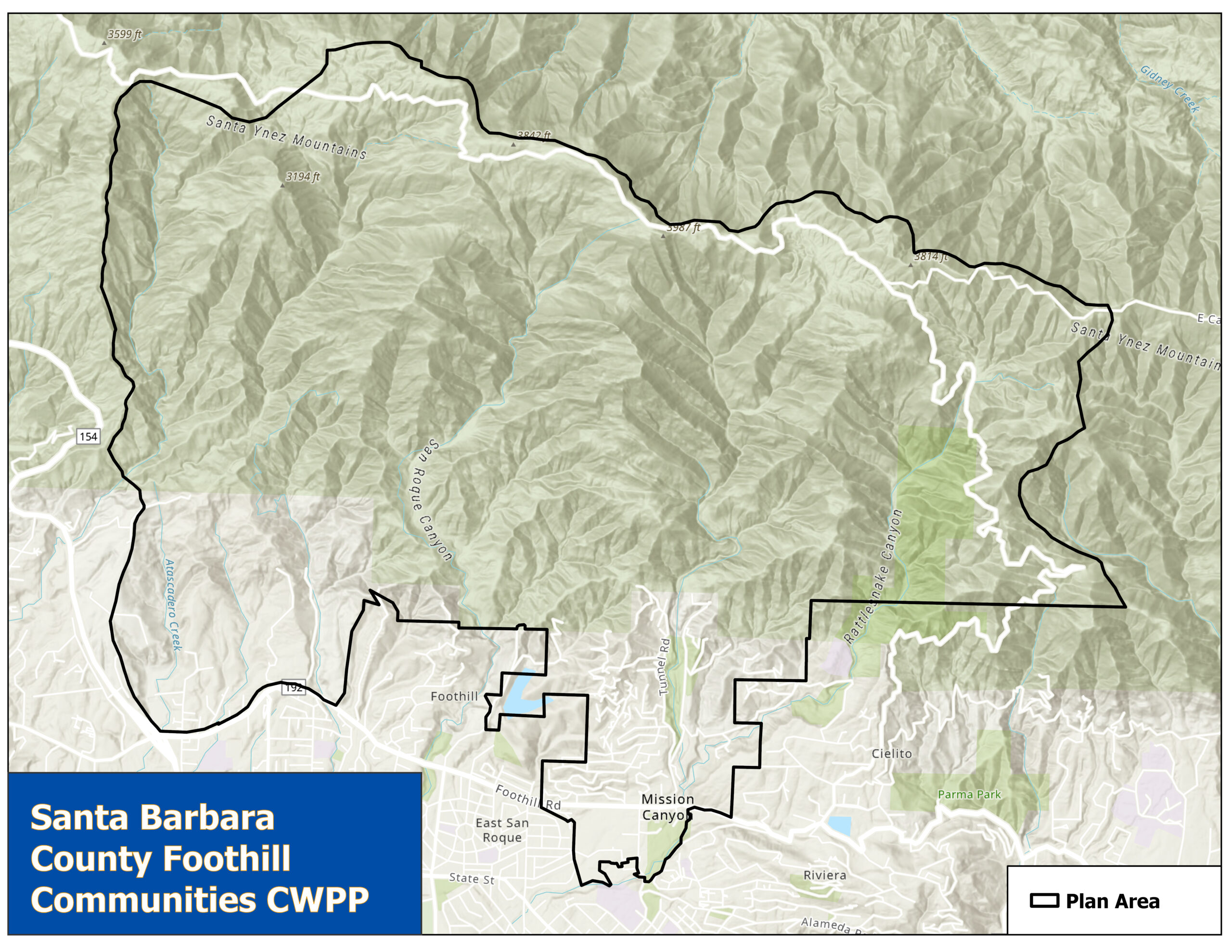
The Plan Area consists of unincorporated area in the Santa Barbara foothills generally located north of Foothill Road and east of Highway 154, and includes the communities of Mission Canyon, Barger Canyon, San Roque, and Northridge. The Plan Area has an estimated population of 3,400 people and covers approximately 10,700 acres.

Get involved!
To ensure that the CWPP and Transportation Study reflect the priorities and concerns of the local community, the project team is seeking input from the public, a development team, the County CWPP working group, and applicable agencies. We need community input to help make Santa Barbara safer from wildfire. Please take the community wildfire survey and stay tuned for more information on upcoming community workshops.
Please provide your input! Take the public survey here!
LINK: Public Survey (arcgis.com)
Please visit the project Storymap to find out more about the project and how to get involved!
LINK: Santa Barbara Foothills Community Wildfire Protection Plan (arcgis.com)
